Tuesday 18 December 2012

Seasons Greetings 2012 from FIND Maps

We thought we would take the opportunity to celebrate the festive season by producing a sketchmap.

Created in Sketchmap, see link here
The above example uses a unique map background created with the 'Customise Map' feature. Usually the Google Map comes in its classic map legend, making the different map features like roads and parks easily recognisable. By changing some of the colours, the map background can be made to look more Christmas themed. In this case using a combination of greens. Red text was also added using the extensive range of annotation tools.

To try your own hand at annotating a map just go to sketchmap.co.uk and click on the drawing tools to get started.

Monday 10 December 2012

Managing heritage and archaeology risks for developers

HeritageRisk.co.uk  is an innovative online service designed specifically for archaeology and heritage risk assessment at the pre-planning stage.

Knowing the risk built heritage and archaeological issues pose for a site can
allow developers to identify and mitigate for them at the pre-planning stage
Discussing their new collaborative project, Simon Lewis (Managing Director of FIND) and Chris Thomas (Director of Planning Services at Museum of London Archaeology or MOLA):

Chris     There are a number of excellent testimonials on the FIND website, not just from developers, but from a whole range of organisations.

Simon   Absolutely Chris…I very much see relationships as being central to FIND’s success.  We’re a small company specialising in data and technology.  We work closely with data providers such as Ordnance Survey, English Heritage and so on…then add value to the data we deliver.  One of the ways we can do that is to work in partnership with organisations like MOLA to deliver ‘Data +’. 

Chris     So you’re providing data and its people like us who’re providing the interpretation of that data.

Simon   Exactly…and we’re expanding in several other areas by collaborating with partners who can add that level of expertise.  For example, we’re currently working with a company that specialises in unexploded ordnance in order to deliver online UXO risk reports.

Chris     So what made you think that heritage risk was a good area to get into?

Simon   FIND already delivers a lot of heritage data.  In fact our free site [sketchmap.co.uk] gives people access to data on listed buildings, scheduled monuments, battlefields and so on.  Casual users are often interested in this sort of information, but to a developer it’s absolutely essential.  It’s going to come out at some point in the planning process, so best to know in advance.

Chris     It’s interesting that you mention listed buildings, because we spend much more of our time now looking at above ground heritage.  And the structures we’re looking at aren’t necessarily designated as the greatest buildings.  It’s more a case of people’s perceptions.  And as the general public has greater input into planning decisions, overall perception of the built environment is increasingly likely to become a risk for developers.  And you can’t manage risks if you don’t understand them.

Simon   Exactly…I was always told that a good project is one where there are no surprises.

Chris     At MOLA we try to make sure that developers are informed and prepared.  Having all the information you need in advance is far better than a scenario in which workers on site are standing idle and costs are mounting if a heritage or archaeological issues have suddenly arisen.

Simon   And providing this service online speeds up the process of getting crucial information about a site, understanding any issues and planning for them.
 
Chris     And do you think the online ordering system is straightforward?

Simon   Undoubtedly…everyone is now so familiar with ordering goods and services online that the days of doing this kind of work offline are fading fast.  Ordering is very straightforward.  Users just type in a postcode, view the area, mark up the site and then request a quick report, a detailed report or a full Historic Environment Assessment.

Chris     What impresses you most about MOLA assessments?

Simon   Not only do the reports look great, they’re easy to read and packed with information.  Before embarking on projects like this we seek out the best partners. And when it comes to archaeological assessment, building assessment and heritage in general, there’s no better name than MOLA.

Thursday 22 November 2012

Marine web mapping services: A new era in marine data delivery

As you know, users of terrestrial GIS need no longer source, order and store spatial data. Instead, they access services online and ‘on demand’. Unfortunately, users of marine data have not been so well served. 

Applying advances in GIS to the marine environment have been hampered by the fact that data was frequently hard to source, often encoded and difficult to access for non-navigational purposes. It was also collected and maintained in different formats by departments which failed to communicate with one another and were bound by issues relating to national security and navigational safety.

Examples of marine geodata (from left) bathymetry; seabed DEM; Marine Themes;
seamless Feature Layers overlaying Marine Themes DEM; raster chart.

In recent years, however, initiatives driven by national and pan-national bodies have highlighted the need for marine date to be made more widely available and many leading hydrographic offices have responded positively…paving the way for the development of new WMS, WCS and WFS marine data feeds.

 The disparate nature of traditional marine data collection and its division into different categories (oceanic, coastal approach, ports and harbours) means that integrating this data into a uniform spatial layer presents considerable challenges. Compiling a scaled WMS feed of UKHO raster charts, for example, requires the compilation and de-confliction of hundreds of individual files. The exact display order must be carefully determined to develop a useable and cohesive map background. Similar de-confliction is also needed with vector data derived from an electronic version of the raster chart. Only once these issues are fully resolved is it possible to deliver consistent marine mapping data in a meaningful format.

In order to create ‘on demand’ services it’s also necessary to address bandwidth issues, optimise data for efficient delivery, ensure that the server infrastructure is efficiently and robustly configured, and to offer secure access.

Previously, many applications have compromised by offering a ‘halfway house’ between immediate data access, security and user operability. A true ‘on demand’ service offers immediacy, flexibility, efficiency and cost savings.

 Happily, working in association with OceanWise (which has secured access to a variety of marine data sources for non-navigational uses) FIND  can now offer:

Marine raster charts service (WMS) 
Marine web map (TMS) 
Marine themes feature services (WFS) 

As more data becomes available we look forward to developing new services to support the growing number of businesses operating within the marine sector. To find out more about FIND’s marine data and services go to our dedicated site MarineFIND.co.uk

 The above blog was adapted from a longer article published in Nov/Dec 2012 Geoconnexion UK, by Jon Coleman, Marine & Environmental Business Manager at FIND and John Pepper, Marketing Director of OceanWise Ltd. 

Read the full article on the MarineFIND website

Thursday 20 September 2012

HeritageRisk.co.uk… a better way to assess heritage

MOLA (Museum of London Archaeology) and FIND are delighted to announce the launch of a new online heritage assessment service for Great Britain, available at HeritageRisk.co.uk.

The online and tablet friendly service, offers planners, developers and surveyors the opportunity to order bespoke heritage and archaeology risk assessment reports, simply by selecting the area of a site on an online map.


Bespoke site assessment reports outline the potential impact of proposed developments on historic buildings, archaeological remains and conservation areas. The service is designed for anyone wanting to know what heritage issues there may be on a specific site. In particular, the service offers vital early-stage insight into risks that may impact on the success of a development.

HeritageRisk front page
By using HeritageRisk, users remove the time consuming process of communicating complex site boundaries and details over the phone or by email. The ease of usability makes this the only heritage assessment service of its kind.

HeritageRisk reports are available in two formats:
  • A ‘rapid’, high-level site assessment that identifies significant archaeological and built heritage risks at the pre-planning stage of development;
  • A ‘detailed’ report that provides more extensive information to help to identify key archaeological and built heritage risks or opportunities for a site and to outline the work likely to be required as part of a planning consent. 
Chris Thomas, MOLA Senior Consultant, said: “All HeritageRisk reports are produced by our expert heritage consultants who have advised on more than 5,000 development projects throughout the UK. HeritageRisk reports are hugely beneficial to developers and enable them, early in the development cycle, to assess the archaeological and built heritage risks to their site. This crucial information outlines the work likely to be required as part of a planning application and following planning consent.

Simon Lewis, FIND’s Managing Director, said: “FIND has worked closely with MOLA to create an online site identification service that combines mark-up tools within a simple step-by-step report ordering process. It allows the experts to concentrate on writing the reports, rather than asking the client routine questions and pinpointing the site.

HeritageRisk reports start from £320, and include the full range of historical maps from Ordnance Survey going back to 1890. For more information, please visit HeritageRisk.co.uk

Monday 13 August 2012

Delivering map data over the internet: A bit about ‘data as a service’

Any decision is only as good as the data it’s based upon. However, keeping databases current can be time-consuming and laborious. Ideally data would be instantly accessible and maintained by experts available over the web.

Well, that solution is here.

FIND Maps, an online mapping specialist, has just released a range of unique data feeds for desktop mapping software. Rather than having data gathering dust on DVDs or languishing somewhere on a network file system, this new service exploits the true potential of ‘data as a service’.

FIND’s approach allows users to access maps and data on demand over the internet from cloud servers. This means that they no longer need to hold a full copy of the data they want to access, or to go through the process of ordering DVDs, awaiting delivery, downloading files and maintaining them in-house. With many years experience of providing data over the internet, FIND Maps has harnessed the benefits of recent technical advances to deliver this new data service. The result is instant access to professionally maintained remote data from a user’s desktop mapping application or GIS.

FIND Maps specialises in the provision of geo-data for professionals. Until recently this was only available to purchase and download. Now, as a result of consultation with clients and collaboration with data partners, FIND has launched a range of online data services. Focussing initially on the marine engineering sector, FIND currently offers charts, vector themes, depth data and map tile sets. Other datasets from the FIND Maps archive will be available soon. These will include bedrock and flood risk, as well as core map sets from Ordnance Survey.

Most GIS software can now access data over the internet - usually via WMS or WFS feeds. Importantly, this data can also be used directly within online mapping applications built on web mapping services such as Google Map. This opens up a radically different way to use and share ‘data as a service’ without the need for expensive CAD and GIS systems. At 
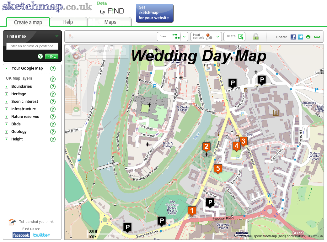
sketchmap.co.uk, FIND’s public mapping portal, users can add layers to basemaps, draw, annotate and then share links to maps they’ve created. This free site gives just a glimpse of what can be achieved using online data.

Sketchmap.co.uk  with BGS Superficial Geology and Local Authority boundary layers added
In our fast changing technological world software companies release new apps, versions and upgrades every week. More and more of these are being delivered via the cloud. Microsoft, the biggest of them all, recently introduced a cloud based version of its popular Office suite. Buying, or renting, applications in this way offers substantial costs savings as there’s no need for users to purchase, administer, maintain and host data themselves. It’s therefore easy to see why more and more users are demanding cloud based services.

FIND offers free monthly seminars in central London for those who’d like to explore the possibilities offered by ‘data as a service’.

Find out more about marine data feeds

Tuesday 26 June 2012

The Internet data deluge

A fantastic new infographic from Visual News shows just how much information and data the Internet generates every minute.

How Much Data is Created Every Minute?
Infographic by Visual News

Friday 22 June 2012

"Wind rush" overwhelms Scottish planning authorities

A second Scottish local authority has called for a temporary halt on wind farm applications following an onslaught of inappropriate bids.

Causeymire Windfarm, Scotland CC Image courtesy of Shandchem on Flickr
Causeymire Windfarm, Scotland. CC Image courtesy of Shandchem on Flickr
Fife Council claim developers are ignoring guidelines on approved sites and are swamping planners with "opportunistic" applications.

Fife Council leader Alex Rowley said: "The pressure being put on our planners is coming from the sheer number of wind turbine applications that are currently being submitted across all parts of Fife.

"We have already pinpointed areas of search across the kingdom following extensive consultations where turbines could be potentially sited. However, developers are simply ignoring these when making applications which, in turn, is making life more complex for our planning teams."

Fife's move follows Aberdeenshire Council earlier this year who asked for a six-month moratorium after becoming overwhelmed by a "wind rush" from developers. With a potential five-year gap between the initial planning application and the final decision underlies the importance of getting planning applications done well.

FIND has a number of maps, documents and spatial datasets that can be used to help wind farm site assessment, contribute to Environmental Impact Assessment and planning applications. Click on the below links to find out more:

Tuesday 22 May 2012

First MarineFIND data seminar a success

The first of our monthly seminars was held last week. It clearly provided a good deal of stimulation and food for thought as the Q&A session at the end overran…always a good sign.

If you missed the first seminar we’d be happy to see you at the next one – scheduled for Thursday 21 June. The London venue is just three minutes’ walk from Waterloo on the South Bank. To book your place simply email: marinesupport@findmaps.co.uk

Please see previous blog for more details.

Tuesday 8 May 2012

Monthly marine data seminars from MarineFIND

If you’d like to explore how marine data could benefit your industry, you may be interested in one of our marine data seminars.

The second of these free events is scheduled for Thursday 21 June and will be held in central London, within walking distance of Waterloo station.

Each seminar will feature a comprehensive review of the marine data currently available, what’s in the pipeline and the potential this offers.

Speakers:
  • Simon Lewis and Jon Coleman, FIND Maps 
  • Mike Osborne, OceanWise 
  • Andy O’Keefe, Virtalis 


Outline programme: ‘New depths in Marine Data Exploitation’ 


Session 1- Core Products:

  • Marine data sets 
  • Environmental/geological/ecological 
  • Coverage 
  • Web services WMS, WFS and WCS 
  • Global options 

Session 2- Integrating Marine and Land Data:

  • Regulatory framework 
  • Coastal Zone management tools 
  • Projection and vertical issues 
  • The complete picture 
Lunch

Session 3- Demonstration of web based services

  • WMS data 
  • Google tile set data 
  • WFS services 
  • WCS data 

Session 4- The 3rd and 4th Dimensions

  • Why these dimensions are critical for Marine Data 
  • Visualising in 3D 
  • Planning in 3D 
  • Designing in 3D 
  • Volumetrics 
  • Real time sensor integration with data 

Session 5- Questions and Feedback 

  • Each seminar will end with an informal opportunity to discuss project specific issues.

For further details or to book your place for the first seminar, please contact marinesupport@findmaps.co.uk

As a bonus, attending a seminar entitles you to a 15% discount on your next marine data or software order.

Find out more about marine data and services from FIND

Wednesday 2 May 2012

Try EnviroFIND free of charge

During May 2012 new users are being offered a one week free trial of our innovative EnviroFIND service.

EnviroFIND has been specifically designed for those who need to view Environment Agency and BGS/NERC data with the assurance that all licensing and royalty issues are taken care of. It’s currently the only website offering instant access to this information for commercial use at flat or reduced rates. It also offers the familiar FIND online map tools.

Jonathon Coleman, FIND’s Environmental Business Manager, said “The major advantage of EnviroFIND is that it allows users to view and query key environmental data and obtain immediate site intelligence in advance of ordering detailed and expensive reports”.

EnviroFIND is available for a small monthly subscription (starting at just £28). Subscribers are also entitled to a discount on additional BGS data sets.

If you’d like to take advantage of this one week free trial, send an email to support@findmaps.co.uk asking for a special login. If you then decide to become a subscriber there’s a 15% introductory discount.

A quick video about EnviroFIND can be found at http://www.findmaps.co.uk/enviroFind or seen below


Wednesday 25 April 2012

‘For Sale’ boards banned for the next 10 years

In some areas of London attractive, historic streets used to be littered with ‘For Sale’ and ‘To Let’ boards. This relatively unregulated advertising was particularly unwelcome in conservation areas.

 In order to tackle the problem, Hammersmith and Fulham Council introduced new regulations covering selected conservation areas. Within these areas it became necessary for agents to apply for prior written consent before displaying a board.
Baron's Court Station in Baron's Court conservation area, Hammersmith and Fulham, London
CC Image courtesy of 70023venus2009 on Flickr
During the first 12 months the Council brought 19 prosecutions against agents who flouted the new regulations. The Council won every case and agents were fined between £100 and £3,500. A further 15 cases are pending.

Following a successful trial period, the regulations have now been extended to cover a wider number of areas for the next 10 years.

Consultation has shown that 98% of residents approve of the new measures.

Cllr Botterill said: “Thankfully, the vast majority of agents are respecting the ban and, while the local property market remains strong, the reward is that our historic conservation areas retain their charm and elegance rather than resembling some kind of gaudy high street.”

Conservation Areas on FINDmaps.co.uk 
At FIND we’ve mapped the conservation areas within the majority of UK local authorities. Quickly viewing this information online could help to save you time, trouble and expense.

FIND offers conservation areas to view and print over ordnance survey maps. Tell me more

Wednesday 18 April 2012

Adding online maps and annotation tools to Hometrack’s SiteMAP

FIND is now providing mapping capabilities to Hometrack’s SiteMAP, a web-based information platform designed specifically for house builders and developers.

FIND have integrating a suite of new mapping tools into SiteMAP for  clients to use.

OS MasterMap annotation tool on SiteMap
The benefits of FIND’s addition to SiteMAP couldn’t be simpler - once an area has been defined, the maps can be downloaded within minutes. These can then play a critical role in a developer’s site analysis and decision making.

The new mapping functionality on SiteMAP includes:
  • Viewing and printing of OS MasterMap 
  • Performing site investigations and producing planning application maps 
  • Viewing and printing of geology and flood risk maps 
  • Advanced map drawing  tools 
Stewart McRae of Hometrack comments, “The addition of FIND’s offering to SiteMAP provides all the essential information a developer needs prior to acquiring land.”

If you would like to discuss adding mapping tools into your site please contact: consultancy@findmaps.co.uk

Thursday 1 March 2012

New OS Pricing for viewing and printing

FIND Maps is pleased to announce a big shake up to its Ordnance Survey Mapping prices.

The new pricing offers:
  • Free initial online viewing of FIND Map/OS Plan 
  • Up to 20% off FIND Map/OS Plan prints 

Simon Lewis, FIND’s new Managing Director, said “Since joining FIND I’ve been keen to reduce our viewing charges. I’m very pleased that clients will now be able to get on with using all the great features on the site without worrying about initial viewing costs.

Ordnance Survey's Ben Nduva, said “We welcome this new pricing from FIND Maps, in the current climate it's rare to see price reductions. Their slick mapping portal makes all the features of OS MasterMap really stand out and at a price that increases the value to their users."

The new pricing will be rolled out in early March. Initial online viewing for up to 15 ha will then be free of charge and 3ha prints will cost just £12 + VAT.

Find out more about FIND Map / OS MasterMap
View mapping prices

Wednesday 15 February 2012

Sketchmap.co.uk launches

Today we announce the launch of sketchmap.co.uk – a unique, easy-to-use website where people can quickly create and share maps.
Sketchmap's features include:
  • six different drawing tools, including a fun freehand ‘sketch’ function
  • choice of four different map backgrounds including Google and Ordnance Survey
  • ‘copy link’ function for sharing maps
  • sharing maps by Twitter and Facebook
  • PDF option for printing

To create a map users simply go to the appropriate map location, then simply draw, write or add symbols.  Clicking the ‘copy link’ icon allows them to paste a link to their map into an email or to Facebook/Twitter etc.


To view a map users click on the link.  If they want to make any changes they can unlock the map using the ‘padlock’ icon.  This new map can then be shared using the ‘copy link’ icon.

Simon Lewis, Managing Director of FIND, says; “The key feature of sketchmap is that it's designed to be very quick and easy to use - so there’s no logging-in and no special software or training is necessary.  From arranging a meeting place to sharing your favourite picnic location, it's incredibly simple to use - just sketch a map and share it in seconds.”

The ‘Your Google Map’ feature allows users to custom colour and style every feature on a Google map.

Sketchmap also allows users to enhance their maps by adding special layers showing height contours, administrative boundaries, national parks, heritage sites, bird sanctuaries, bedrock geology and much more.

Sketchmap provides the tools to quickly and easily make fun, useful, interesting and informative maps.

To learn more about sketchmap and create your own maps visit http://sketchmap.co.uk/

Wednesday 11 January 2012

Google doodle marks father of geology's birthday

Today’s ‘Google doodle’ marks what would have been the 374th birthday of Nicolas Steno, known as ‘the father of geology’.
Nicolas Steno's Google Doodle
Steno is famous for his ‘principle of original horizontality’ – the theory that rocks are formed in horizontal layers.  From this, he concluded that unless they have been disturbed, the bottom layers are the oldest.  In his time, this was revolutionary thinking.

Horizontal rock formations, Petra, Jordan.
Picture copyright: Gill Lockett, 2011. Used with permission.
Were he around today, Steno would be dazzled by the range of geological data available online.  At www.findmaps.co.uk you can instantly access geology maps and datasets including Ground Stability, Boreholes, Areas of Potential Underground Mining, Areas of Potential Coal Mining and Areas of Potential Brine Extractions.  In addition, under our new MarineFIND service we now offer undersea geology maps and related datasets.

Find out more about Nicolas Steno:  http://en.wikipedia.org/wiki/Nicolas_Steno
Find out more about modern stratigraphy:  http://en.wikipedia.org/wiki/Stratigraphy