Showing posts with label planning. Show all posts

Monday, 4 August 2014

Video guide: Create 1:1250 A4 Location Plans with findmaps.co.uk

We have produced a video guide to creating 1:1250 A4 Location Plans in FIND Maps. This commonly used feature can be done under 3 minutes using the findmaps.co.uk online mapping application.


FIND Maps offers flexible and efficient OS MasterMap printing and annotation. A range of different map scales can be selected, including 1:1250 and 1:2500. Also, a red-line property boundary can be added to the plot using the 'merge polygon' tool that enables you to quickly trace a property boundary.

Friday, 22 June 2012

"Wind rush" overwhelms Scottish planning authorities

A second Scottish local authority has called for a temporary halt on wind farm applications following an onslaught of inappropriate bids.

Causeymire Windfarm, Scotland CC Image courtesy of Shandchem on Flickr
Causeymire Windfarm, Scotland. CC Image courtesy of Shandchem on Flickr
Fife Council claim developers are ignoring guidelines on approved sites and are swamping planners with "opportunistic" applications.

Fife Council leader Alex Rowley said: "The pressure being put on our planners is coming from the sheer number of wind turbine applications that are currently being submitted across all parts of Fife.

"We have already pinpointed areas of search across the kingdom following extensive consultations where turbines could be potentially sited. However, developers are simply ignoring these when making applications which, in turn, is making life more complex for our planning teams."

Fife's move follows Aberdeenshire Council earlier this year who asked for a six-month moratorium after becoming overwhelmed by a "wind rush" from developers. With a potential five-year gap between the initial planning application and the final decision underlies the importance of getting planning applications done well.

FIND has a number of maps, documents and spatial datasets that can be used to help wind farm site assessment, contribute to Environmental Impact Assessment and planning applications. Click on the below links to find out more:

Friday, 30 September 2011

The National Planning Policy Framework debate

It’s supposed to be the season of ‘mists and mellow fruitfulness’, but the mood in the countryside is far from mellow when it comes to the Government’s proposed changes to the National Planning Policy Framework (NPPF).

Will we be seeing more of this in the countryside? Photo: Gene Hunt, Creative Commons, FLIKR
Alarming headlines warn us that the new proposals represent “a threat to the countryside” (Daily Mail), “threaten [the] green belt” (Telegraph) and “will destroy Britain” (Guardian). So why are the headlines so alarmist?

The environmental community fear that their concerns about unchecked rural development will be brushed aside in a mad rush to stimulate the economy – something they regard as short-termist.

A loose coalition of individuals and organisations including the Campaign to Protect Rural England (CPRE), the National Trust and Greenpeace have come together to voice their concerns. They are calling upon MPs to fight against the proposed changes and are hoping for an outcome similar to the u-turn on the sale of national forests.

However, there is significant support for the proposed planning reforms from the business community. Stewart Baseley, Executive Chair of the Home Builders Federation, said: “Scaremongering by anti-growth groups has resulted in negative reports and a false impression that threatens to stunt constructive discussion over how to shape and guide development in the future.”

During Prime Minister’s questions in the Commons on 14 September, Mr Cameron tried to pour oil on troubled water, telling MPs that proposed changes would favour localism over centralism and that local communities therefore had nothing to fear. He also pledged that green belt land would be protected. 

Nonetheless, the new proposals represent the biggest shake-up of planning since the Town and Country Planning Act of 1947. The consultation period ends on 17 October.

Whatever the outcome of the debate it’s our belief that the best decisions are made based on good information. FIND Maps offers all the information required to build a complete picture of the spatial context of a planning application.

Whether you need mandated environmental reports, high resolution aerial photography or OS MasterMap, at FIND Maps we pride ourselves on providing timely access to professional data.

Wednesday, 17 August 2011

Demolition Man

If you’ve ever endured the noise and inconvenience caused by neighbours and their DIY projects, spare a thought for Lucy Grothier. Lucy, who lives in a Regency semi in Twickenham, was at home when a bulldozer began to demolish the adjoining property.

Location of Demolished Property in Trafalgar Road Conservation Area
John Johnson, the owner of the property in question, had been granted planning permission for an extension and basement. While this work would have involved partial demolition, he decided that it would make more sense to demolish the entire building and start from scratch.

Mr Johnson was fined a record £80,000 plus costs for flouting planning rules within a conservation area.

Detailed information about conservation areas can be found at www.findmaps.co.uk, where you can also view information about built heritage and, indeed, planning applications.

Further valuable information can be found under planning applications on the FIND web portal. This layer displays details of all planning applications for properties, whether granted, refused or pending. The applications can be filtered to display information by month, year, size, property type, development type or status of application.

Wednesday, 20 October 2010

Maps of High Speed Rail Link through Warwickshire

Earlier this year the Department for Transport announced the proposed route for a high speed rail link between Birmingham and London Euston. For about a third of its length the proposed route passes through Warwickshire.

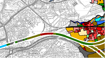
Above, PDF of a background map with several geo-datasets layered over the top, including the proposed HS2 rail route through Warwickshire, property locations and ownership.

This will have a considerable impact on the area a major consultation is planned for next year. Following a chat with Mariam Crichton, Director of FIND, the team at Warwickshire County Council became excited about the prospect of using PDF mapping layers to inform that consultation process.

The team produced layered maps showing the proposed route of the rail link through the county. The maps show the locations of WCC property, ecological, archeological and historic landscape sites along the route. Also, the maps link to the detailed plans on the HS2 website.

Because PDF maps can be viewed regardless of hardware or operating system this makes them extremely accessible to the general public. In addition, they can be applied and viewed either individually or built up in layers. This gives much of the functionality of a sophisticated online mapping system, but at a fraction of the cost.

Using maps in this way has not only enabled the team at Warwickshire to inform the public about plans and the development of those plans, it has also allowed a broad range of interested parties to become involved in the process. The maps have also prompted people with detailed local knowledge to give valuable feedback. 

One of the team told us, "PDF maps have been of great help. We have had incredible user feedback from the public. It's a fantastic way to provide a wealth of mapping data in an easy to understand, accessible format. Users have even identified flaws which we have been able to correct."

At FIND we are delighted that the GIS team at Warwickshire County Council has used PDF mapping in such an innovative and imaginative way. Their work has helped to show the public what a powerful tool it can be.

HS2 WCC website

Monday, 18 October 2010

Avoiding the new conservation area constraints for estate agents

Recently, several Local Authorities have banned 'For sale' boards within conservation areas. In London this policy has already been adopted by several boroughs.

Kensington and Chelsea were the first to enforce the ban on 27th September shortly followed by Camden, Hammersmith & Fulham, and Westminster. The same restrictions currently apply in parts of Bath, Brighton, and Bristol; more Local Authorities are expected to follow suit.

Above, Conservation Areas over the FIND OS Plan map (OS MapsterMap Topography, 1:1250)

When new regulations like this are introduced it is essential that planners, developers and estate agents know about them. Failure to keep abreast of changes can result in additional costs and even legal action.

If you have the time to devote to searching for detailed information about how these restrictions apply you will find it no doubt tucked away on individual Local Authority websites. However, we know from experience that this can involve trawling through long and detailed planning documents - often emerging none the wiser about how your site is affected.

At FIND we have already done the searching for you. Our conservation area maps can be instantly viewed online, giving you the information you need to get on with the job in hand.

Conservation Areas on FINDmaps.co.uk
FIND offers conservation areas to view and print over ordnance survey maps.
Tell me more

Friday, 13 August 2010

Government school building scheme cut opportunities

There has recently been a furore about the axing of the (previous) government's 'Building Schools for the Future' scheme, leaving some 715 projects out of 1,500 cancelled, and its impact on the construction industry.


Originally the scheme was meant to revamp all 3,500 schools in England by 2023, and while the governments aims were laudable, the reality was somewhat different; BSF's first target was 200 schools rebuilt by the end of 2008, the number actually rebuilt was 35.

Despite this and the current government's propensity for cuts, this still leaves some 785 projects still available and given the current state of the construction industry, it is vital for companies that these projects still go ahead. It is also important that they try to maximise their profit in this time of recession recovery and enable these valuable projects to come in on time and on budget.

At FIND we have a wide selection of services and data to help these companies to fully realise their projects. From plotting planning applications and Land Registry titles to height maps and 3D building models, along with a wide range of planning and environmental information and cutting-edge consultancy services, we are able to offer our users a holistic solution while saving precious time and money.

Detailed product information on plotted planning applications
Detailed product information on plotting Land Registry titles
Detailed product information on 3D building model
Detailed product information on height maps
Detailed product information on FIND consultancy services

Thursday, 15 July 2010

New 'garden grab' regulation creates headache for planners and developers

New regulations to curb 'Garden Grabbing' have created a real headache for planners and developers. The changes include redefining brownfield land to exclude gardens and abolishing minimum housing density targets.


Why is this such a headache? Well it will be easier for councils to resist applications from developers to build in back gardens. This will hurt the developers who often use this kind of land for their developments, forcing them to look even harder for suitable alternatives. In order to capitalise on a reduced number of sites, planners and developers are forced to rely more and more on desktop site analysis to determine suitability, project costs and highlight potential issues.

Here at FIND, we offer a wide selection of tools and information to aid site analysis for planning and development professionals, from planning constraint mapping, Ordnance Survey mapping, aerial photography and our new Land Registry service. We aim to help planners and developers take the initiative and maximise the potential of the sites they do have access to, while avoiding costly issues like searching for information and the need for site visits, secure in the knowledge that our data is regularly updated, instantly accessible and easily shared with colleagues.